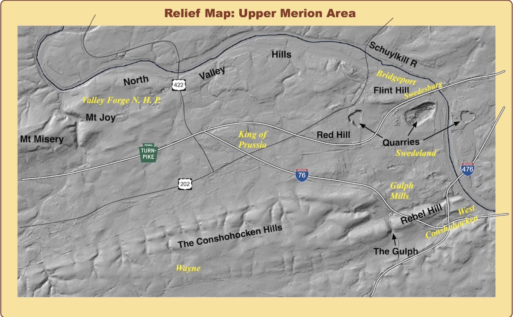
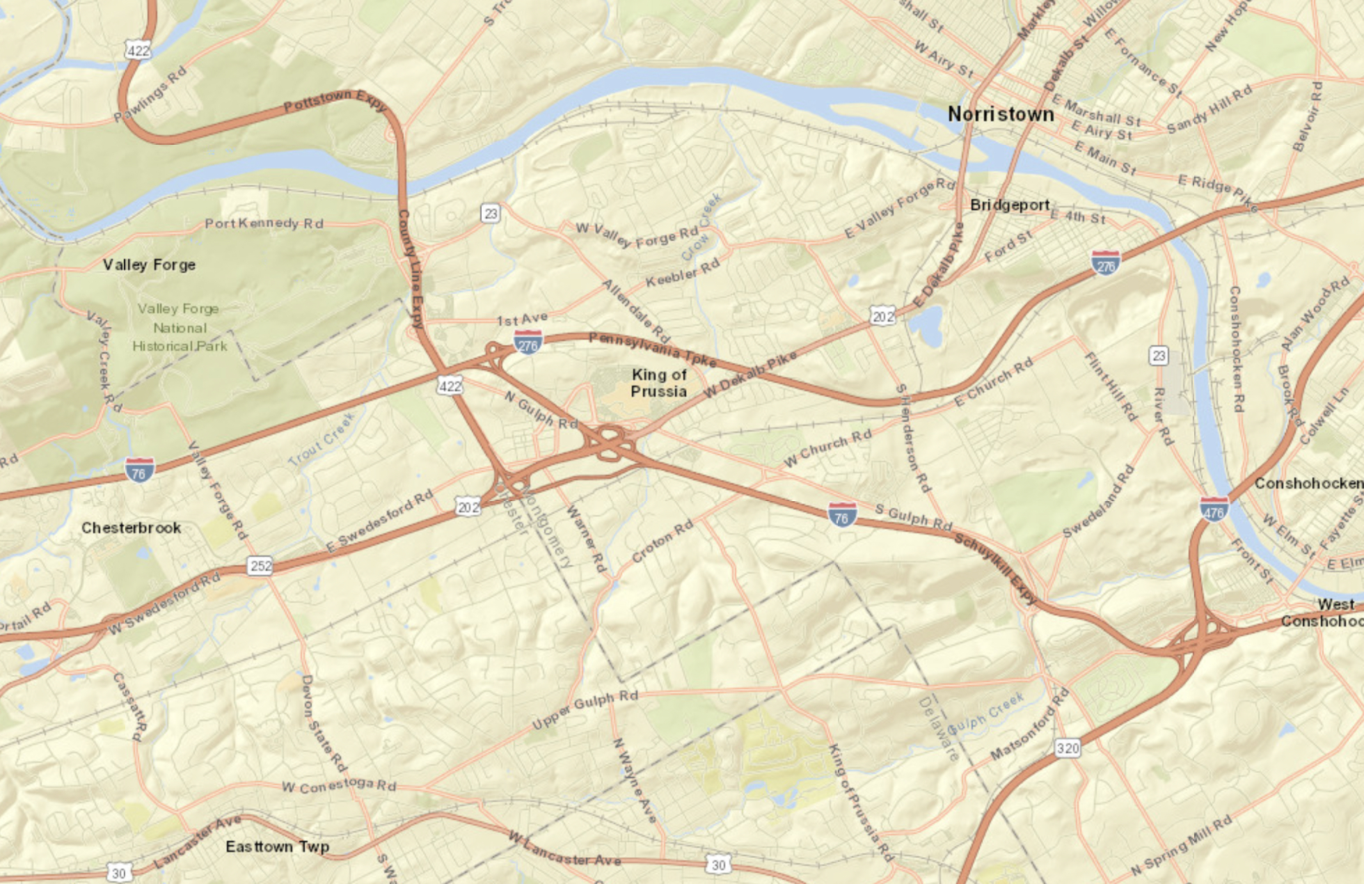
In Bean’s History of Montgomery County, Pennsylvania published in 1884 and edited by William J. Buck, five principal elevations of Upper Merion are described.
MOUNT JOY [in Valley Forge Park] Mount Joy is of a conical form, and is wooded to its top, and forms a beautiful feature in the landscape. It gave name to a manor that belonged to Letitia, daughter of William Penn. Tradition states that he gave the hill this name while on a visit to the neighborhood. It is supposed to be the highest eminence in Upper Merion in the vicinity of Valley Forge. In the time of the Revolution it was strongly fortified, and the remains of intrenchments are still visible on its top.
RED HILL [the area in the vicinity of De Kalb Pike and Town Center Road at the Valley Forge Shopping Center] Red Hill is an eminence somewhat over a mile southwest of Bridgeport. It is a well-known tradition, handed down by several families in the neighborhood, that two panthers were shot on it in the time of the early settlement.
FLINT HILL the area between Swedesburg, Swedeland, and King Manor.
NORTH VALLEY HILL [the area from Township Building site to Heavnerville, Eastburn Hill, and Belmont Terrace back to Abrams and into Port Kennedy] The North Valley Hill is a range following the Schuylkill, and commences a short distance above Bridgeport. It is only of moderate elevation, and is the highest between Port Kennedy and Valley Forge.
GULF or REBEL HILL [the present Gulph Mills area] The Conshohocken or Gulf Hill is a long, narrow range that runs a great way into Chester County; it is a continuation of Edge Hill, which crosses the Schuylkill at Spring Mill, and extends east and west. Nowhere in Montgomery County, on its south side, are iron-ore, limestone or marble found. Geologically speaking, it forms a narrow belt of the primary rocks, with gneiss and talcon slate. The name of Gulf Hill has only been applied in this vicinity from the deep, narrow passage of Gulf Creek through it in its course to the Schuylkill. This natural curiosity will be subsequently described. Rebel Hill is just outside of the borough line of West Conshohocken, and between the Township Line road and Gulf Creek.
Probably one of the most fertile tracts of land in Montgomery County is that portion of the township lying along the Schuylkill, between Bridgeport and Gulf Creek, and extending west for about a mile and a half. Within this space limestone and iron-ore are obtained in abundance, and the stranger views with regret the disfigurations occasioned in obtaining these materials from such beautiful and productive fields. Indeed, in few neighborhoods has nature been so lavish of her choicest gifts. The soil is a loose loam, nearly level on its surface, and so free from stones that no country can produce, probably, any land of easier cultivation. The Swedes, in taking up and settling this tract, showed considerable foresight as to its future importance. In proceeding along the Schuylkill Canal from Bridgeport to Port Kennedy the land is chiefly cultivated to the river, with an occasional margin of trees, making it a shady and agreeable walk.
… Gulf Hill rises immediately on the south side of the creek, opposite the village of Gulf Mills, is quite steep, and is wooded to the top. About three-quarters of a mile from this place a grist-mill is standing in a romantic situation, on the west side of the Gulf road, and to the antiquary is an object of interest. It was built in 1747, and is known as the “Old Gulf Mill.” In 1858 it was owned by Rebecca Thomas, and now belongs to Henderson Supplee. This is probably the oldest mill now standing in Montgomery County, and, excepting some of its machinery, it is believed to have undergone no alteration since its erection. It is built of stone, and may yet with care stand for centuries.
It was, no doubt, in its day considered a great affair. On William Scull’s, map of Pennsylvania published in 1770, the “Gulf Forge” is marked as being in this vicinity.


